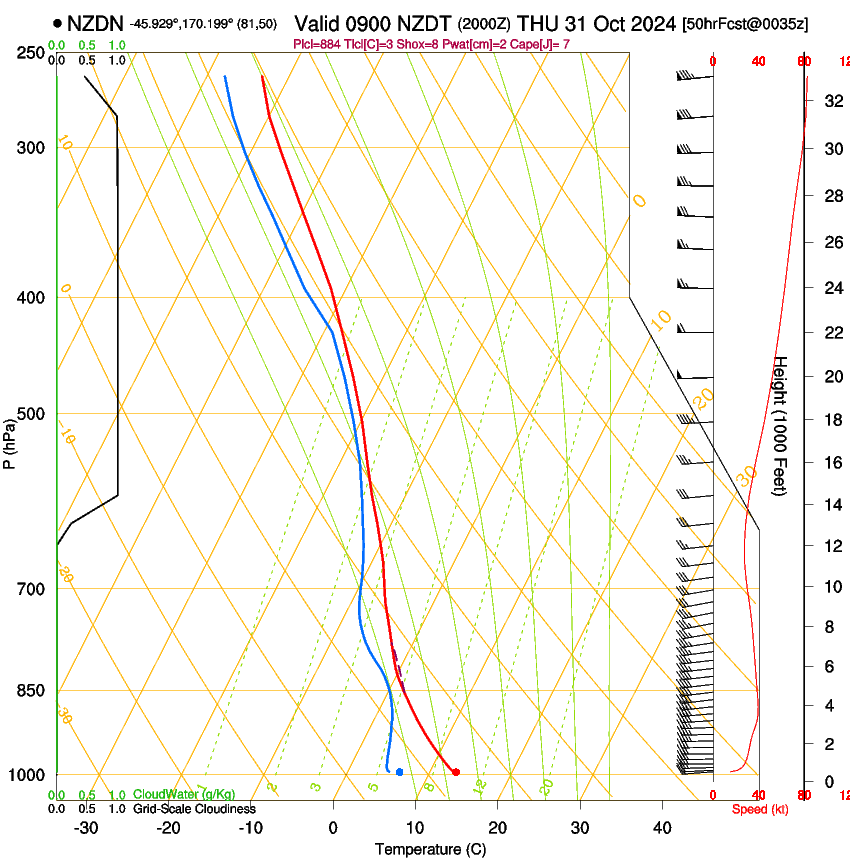
Dunedin Airport (NZDN), Thursday 31st of October 2024
Upper air soundings show temperature, dew point and winds with altitude. This information can be used to evaluate stability, cloudbase, top of cloud, wind profile, and many other athmospheric features. A very good introduction to these diagrams (specifically tephigrams, which the SkewT-LogP diagram below is very similar to) can be found here (hosted with permission from Dr Ian M. Brooks).
|
|
 |
Note that the scale often changes between images, this can make the same colours actually show a different quantity from image to image.
This page loads all the images in the background, and allows you to scroll through them by moving the mouse pointer over the time (shown on the left) of the image you are interested in. It may take some time for images to load in the background; the time is greyed out when loading. This page requires JavaScript.